
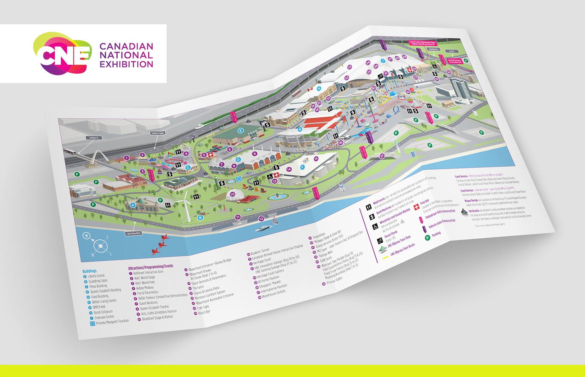
Canadian National Exhibition (CNE) map design & illustration 2017
Core were approached by Field Day Inc. to assist with the layout and illustration of the 2017 CNE map.
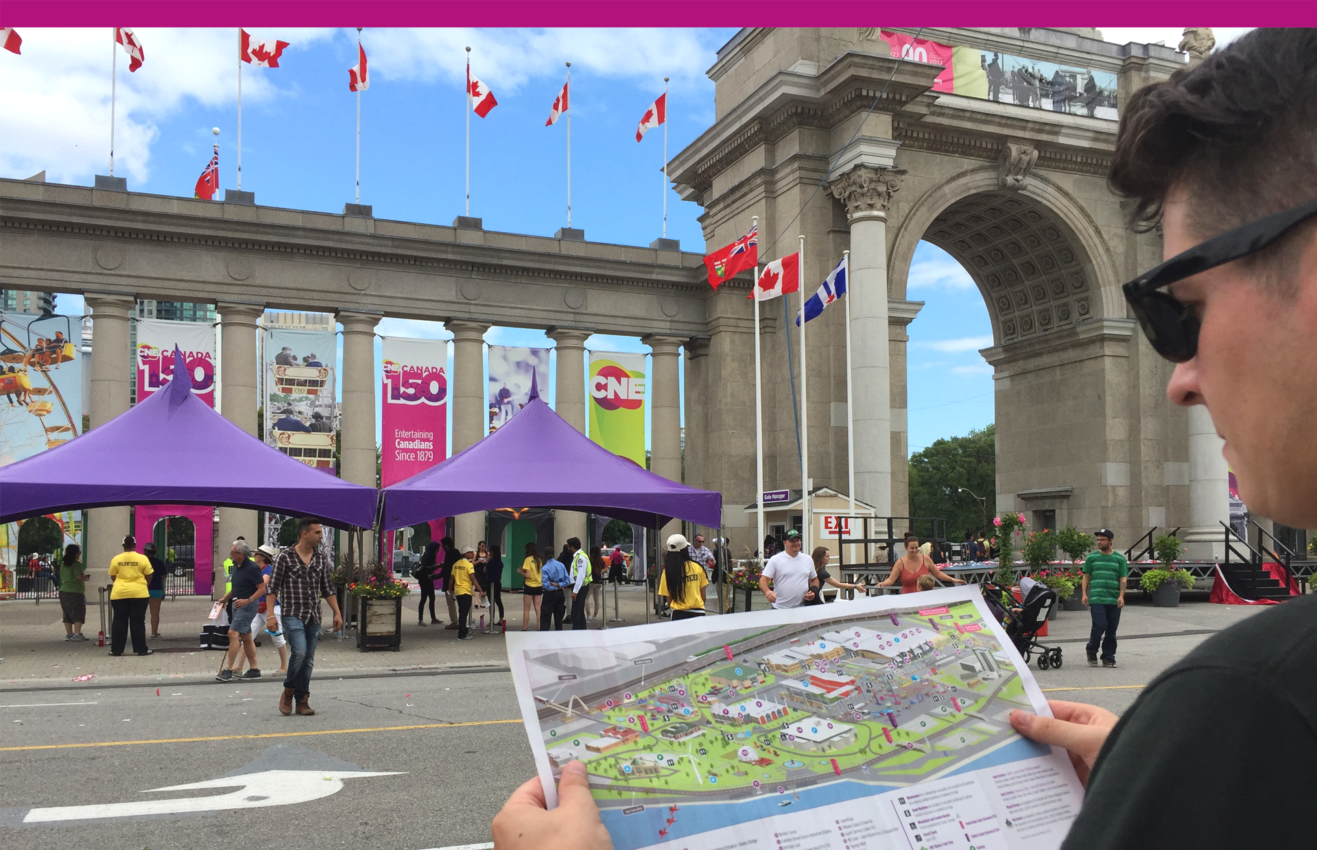
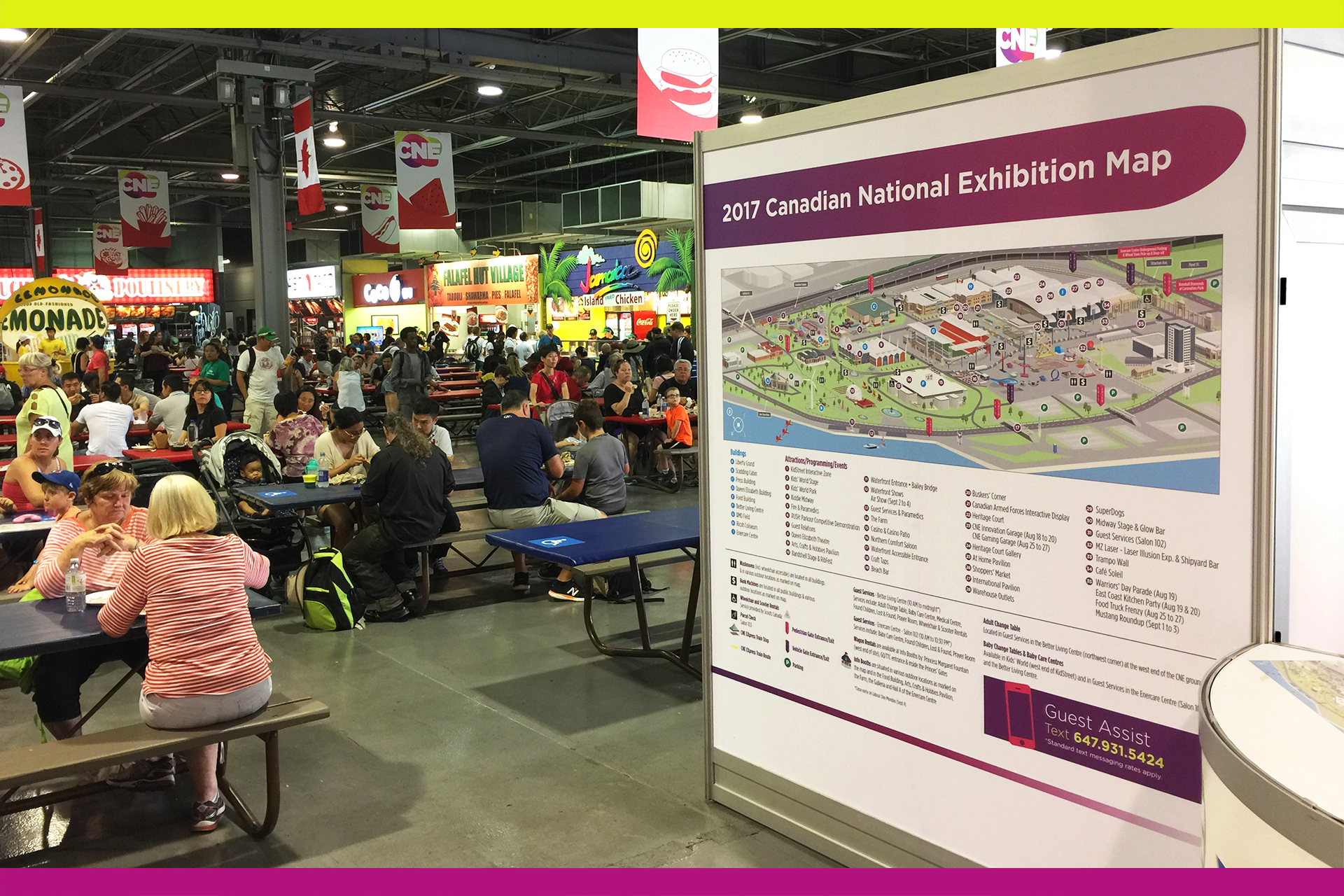
Guiding 1.5 million visitors around the annual exhibition was proving difficult, given the expansive site of Exhibition Place, with it's many buildings and parks.
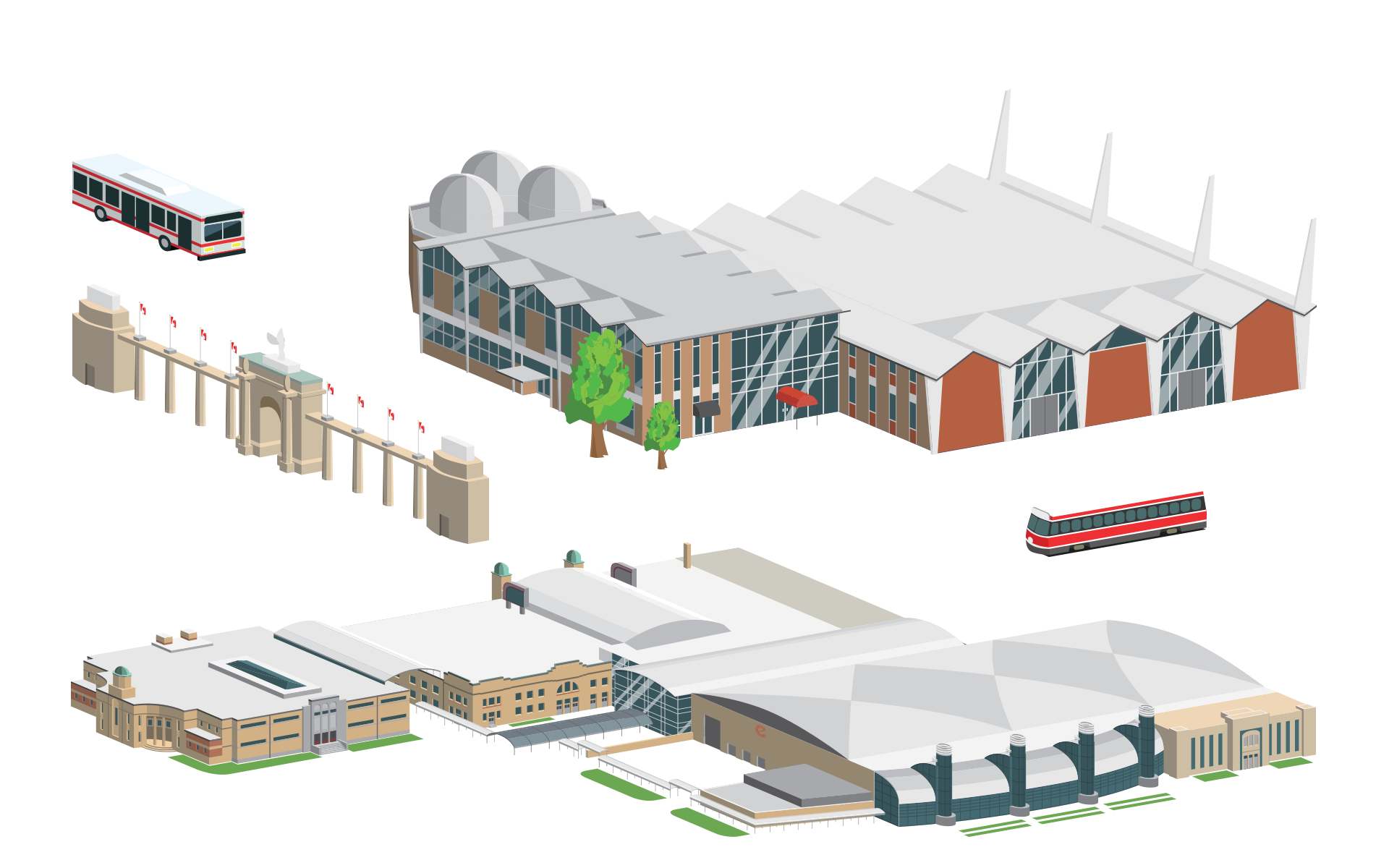
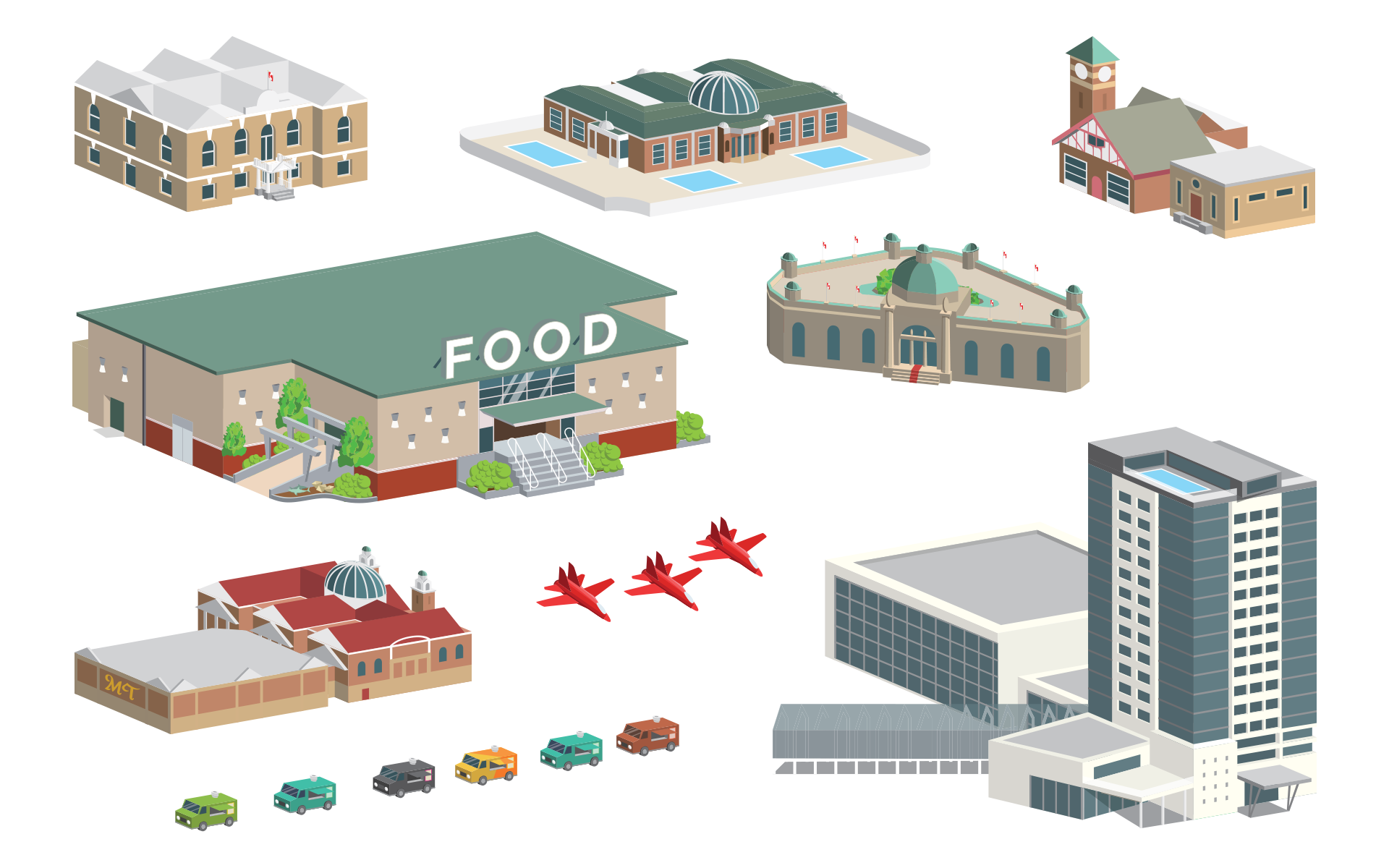
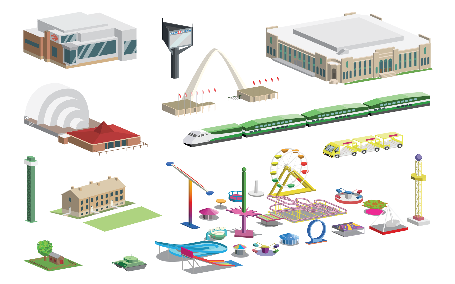
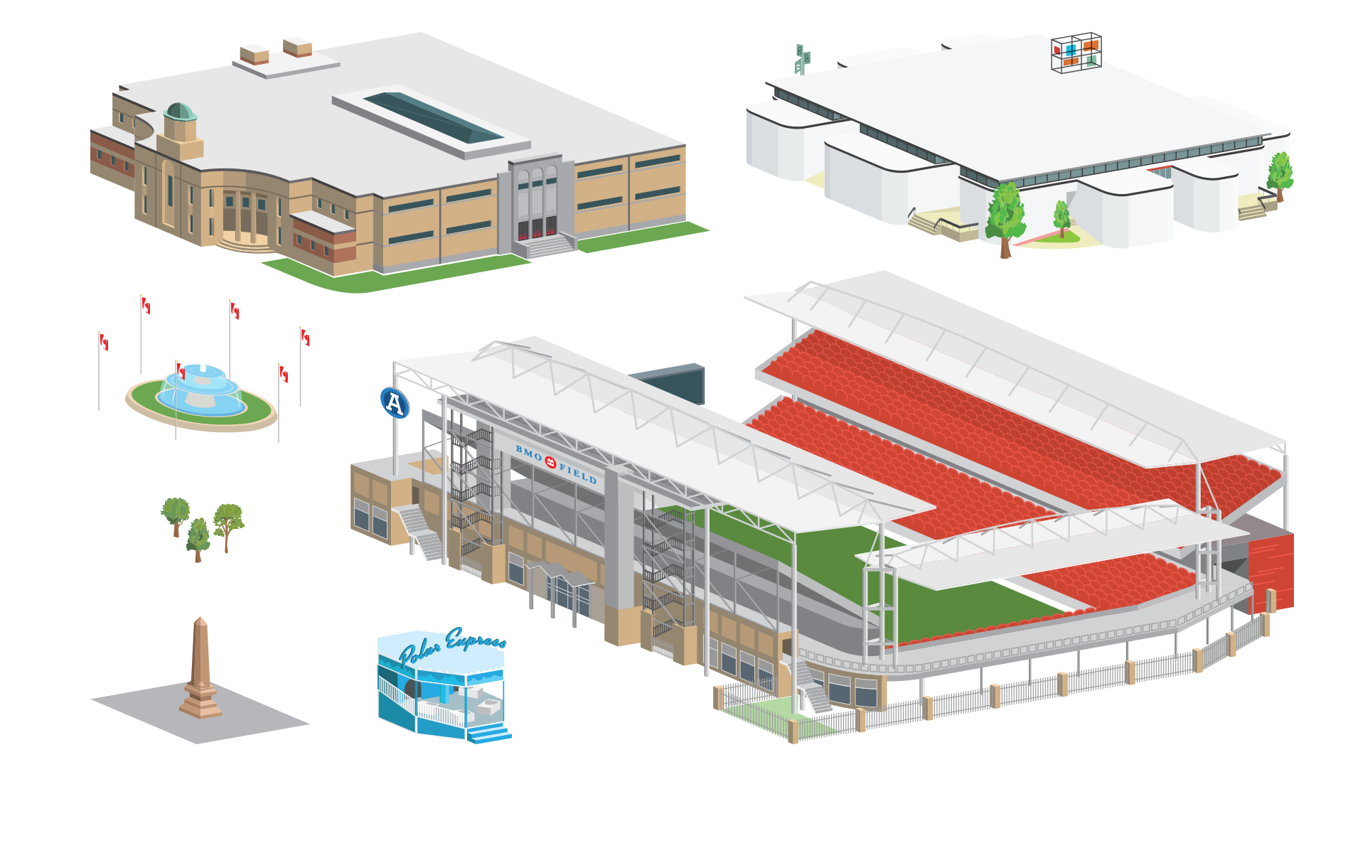
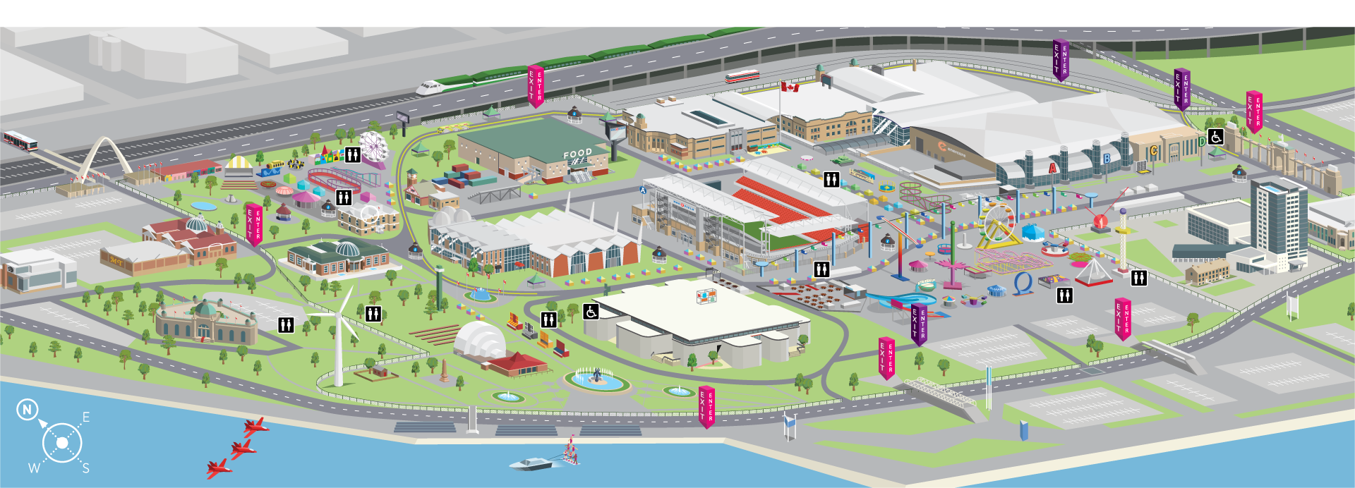
Tasked with creating a map that would use ground-level landmarks to guide the way, the previous birds-eye-view map made way for an isometric map that enabled viewers to establish where they were based on a visible reference point, whether it be a building, ride or landmark.
The key was to establishing the correct isometric angle to fit the entirety of the site, whilst also utilising the right amount of detail in the illustrations and balancing proportion and scale of smaller landmarks. The illustration required just enough detail for viewers to recognise the features and facades of their surroundings whilst avoiding cluttering the map.
Core were approached by Field Day Inc. to assist with the layout and illustration of the 2017 CNE map.
Guiding 1.5 million visitors around the annual exhibition was proving difficult, given the expansive site of Exhibition Place, with it's many buildings and parks.
Tasked with creating a map that would use ground-level landmarks to guide the way, the previous birds-eye-view map made way for an isometric map that enabled viewers to establish where they were based on a visible reference point, whether it be a building, ride or landmark.
The key was to establishing the correct isometric angle to fit the entirety of the site, whilst also utilising the right amount of detail in the illustrations and balancing proportion and scale of smaller landmarks. The illustration required just enough detail for viewers to recognise the features and facades of their surroundings whilst avoiding cluttering the map.